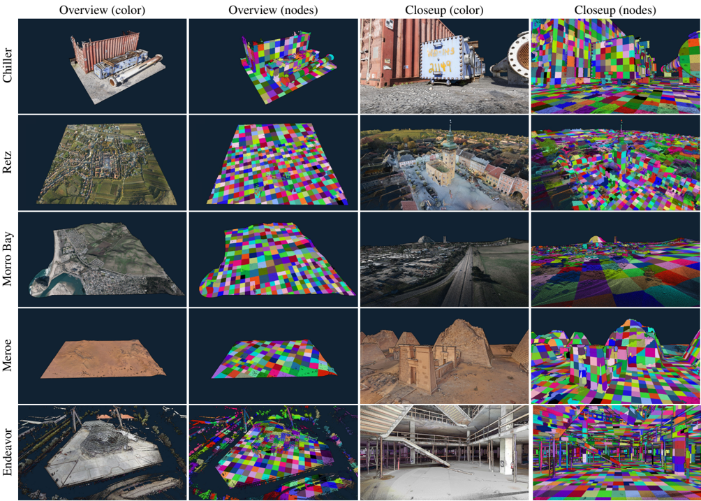
## Collage of Geospatial Visualizations: Location-Based Scene Analysis
### Overview
The image is a grid of 10 sub-images organized into five rows (locations) and four columns (views). Each row represents a distinct location (Chiller, Retz, Morro Bay, Meroe, Endeavor), with two overview views (color and node-based) and two closeup views (color and node-based). The visualizations use color-coded patterns to represent spatial data, with node-based versions emphasizing geometric segmentation.
### Components/Axes
- **Rows (Locations)**:
1. **Chiller**: Industrial setting with containers and machinery.
2. **Retz**: Aerial view of a town with green fields and buildings.
3. **Morro Bay**: Coastal landscape with water, cliffs, and urban areas.
4. **Meroe**: Arid desert terrain with ancient pyramids.
5. **Endeavor**: Industrial/commercial structure with scaffolding.
- **Columns (Views)**:
1. **Overview (color)**: Full-scene color imagery.
2. **Overview (nodes)**: Pixelated, color-coded segmentation.
3. **Closeup (color)**: Detailed zoomed-in color imagery.
4. **Closeup (nodes)**: High-resolution node-based segmentation.
### Detailed Analysis
- **Chiller**:
- Overview (color): Red shipping containers, metallic structures, and gravel ground.
- Overview (nodes): Grid of multicolored blocks (red, blue, green) representing segmented objects.
- Closeup (color): Detailed view of a white container with graffiti ("2149") and a cylindrical object.
- Closeup (nodes): High-density pixel grid with sharp color transitions.
- **Retz**:
- Overview (color): Aerial view of a town with green fields, roads, and clustered buildings.
- Overview (nodes): Blocky segmentation with green (vegetation), blue (water), and gray (urban areas).
- Closeup (color): Central town square with a church spire and cobblestone streets.
- Closeup (nodes): Dense pixel grid highlighting architectural details.
- **Morro Bay**:
- Overview (color): Coastal scene with cliffs, water, and a mix of urban and natural areas.
- Overview (nodes): Segmentation with blue (water), green (vegetation), and gray (buildings).
- Closeup (color): Roadway leading to a cliffside with parked cars.
- Closeup (nodes): Pixelated road and cliff textures.
- **Meroe**:
- Overview (color): Desert landscape with ancient pyramids and sand dunes.
- Overview (nodes): Segmentation with beige (sand), brown (pyramids), and gray (structures).
- Closeup (color): Detailed view of a pyramid with weathered stone.
- Closeup (nodes): High-resolution segmentation of pyramid edges.
- **Endeavor**:
- Overview (color): Industrial/commercial building with scaffolding and open interiors.
- Overview (nodes): Segmentation with gray (concrete), blue (metal), and green (vegetation).
- Closeup (color): Interior view of a multi-level structure with staircases.
- Closeup (nodes): Dense pixel grid highlighting structural beams and floors.
### Key Observations
1. **Node-based visualizations** consistently use grid-like segmentation to emphasize spatial relationships.
2. **Color-coded closeups** focus on specific objects (e.g., graffiti, architectural details).
3. **Meroe** and **Morro Bay** show natural vs. human-made contrasts, while **Chiller** and **Endeavor** emphasize industrial environments.
4. **Retz** and **Morro Bay** include water features, whereas **Meroe** is arid.
### Interpretation
The visualizations likely represent geospatial or 3D reconstruction data, where "nodes" denote segmented elements (e.g., objects, terrain features). The color-coded patterns may correspond to material types, elevation, or functional zones. For example:
- **Chiller**’s red containers and white structures suggest industrial storage.
- **Retz**’s green fields and blue water indicate agricultural and aquatic zones.
- **Meroe**’s pyramids and sand dunes highlight historical preservation challenges.
- **Endeavor**’s scaffolding and open interiors suggest ongoing construction or maintenance.
No numerical data, legends, or explicit labels beyond location names are present. The absence of a unified scale or legend limits quantitative analysis, but the segmentation patterns imply a focus on spatial organization and material differentiation.