# Technical Document: Ghana Telephone Numbering Plan Map
## Map Description
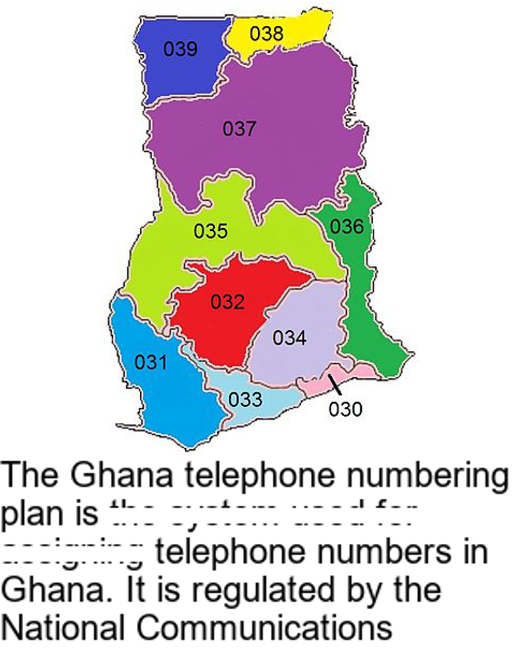
The image depicts a color-coded administrative map of Ghana, divided into 10 distinct regions. Each region is labeled with a three-digit numbering code (e.g., "031", "032") and assigned a unique color. The map is presented on a white background with gray borders.
### Legend
The legend at the bottom of the map provides the following key:
- **Blue (#0000FF)**: 031
- **Red (#FF0000)**: 032
- **Light Blue (#ADD8E6)**: 033
- **Purple (#800080)**: 034
- **Green (#008000)**: 035
- **Yellow (#FFFF00)**: 036
- **Dark Blue (#00008B)**: 037
- **Pink (#FFC0CB)**: 038
- **Light Purple (#E6E6FA)**: 039
- **Light Green (#90EE90)**: 030
### Spatial Grounding
1. **031** (Blue): Located in the southwestern coastal region.
2. **032** (Red): Central region, adjacent to 031 and 033.
3. **033** (Light Blue): Southern region, bordering 032 and 034.
4. **034** (Purple): Eastern region, adjacent to 033 and 035.
5. **035** (Green): Northern region, bordering 034 and 036.
6. **036** (Yellow): Northeastern region, adjacent to 035 and 037.
7. **037** (Dark Blue): Central-northern region, bordering 036 and 038.
8. **038** (Pink): Small northeastern enclave, adjacent to 037.
9. **039** (Light Purple): Small northwestern region, adjacent to 037.
10. **030** (Light Green): Small southeastern region, adjacent to 034 and 036.
## Textual Content
The map includes the following textual information: