\n
## Map: Atel, Romania
### Overview
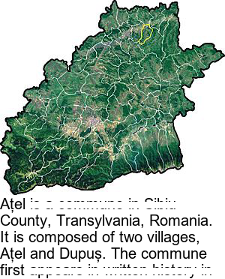
The image depicts a map of the Atel commune in Alba County, Transylvania, Romania. The map is a satellite or aerial view, showing the terrain and river systems. A yellow line highlights a specific feature within the region. Below the map is a block of text providing descriptive information about the commune.
### Components/Axes
The image consists of:
* **Map:** A geographical representation of the Atel commune.
* **Text Block:** A description of the commune, its location, and composition.
* **Highlighted Line:** A yellow line tracing a feature within the map.
### Detailed Analysis or Content Details
The map shows a predominantly green landscape, indicating forested areas and vegetation. A network of lighter-colored lines represents rivers and streams flowing through the terrain. The shape of the commune is irregular, defined by the natural boundaries of the landscape.
The text block reads:
"Atel is a commune in Alba County, Transylvania, Romania. It is composed of two villages, Atel and Dupuş. The commune first…"
The text is incomplete, with the final sentence cut off.
### Key Observations
* The commune is located in a hilly or mountainous region, as evidenced by the terrain depicted on the map.
* The presence of numerous rivers and streams suggests a well-watered environment.
* The highlighted yellow line appears to follow a road or a ridge line.
* The text indicates that the commune consists of two villages: Atel and Dupuş.
### Interpretation
The image provides a visual and textual overview of the Atel commune in Romania. The map highlights the geographical characteristics of the area, while the text provides basic information about its location and composition. The incomplete sentence suggests that the text may have been part of a larger document describing the history or administrative details of the commune. The highlighted line could represent a key transportation route or a significant geographical feature within the region. The data suggests a rural, geographically defined community. The map and text work together to provide a basic understanding of the commune's location and characteristics.